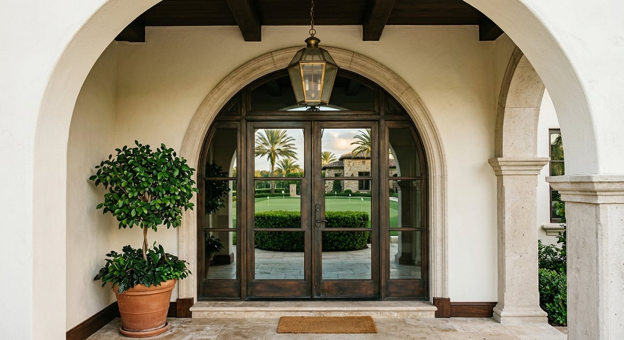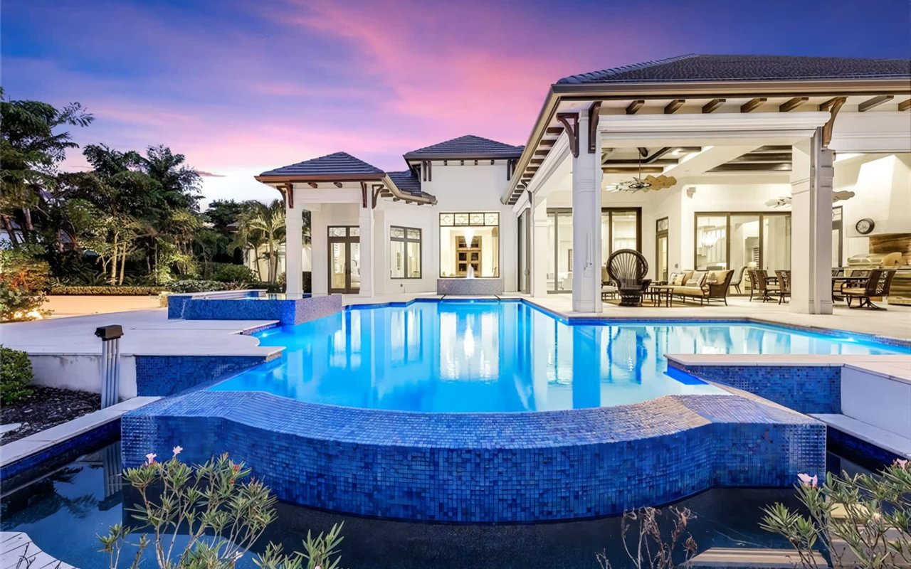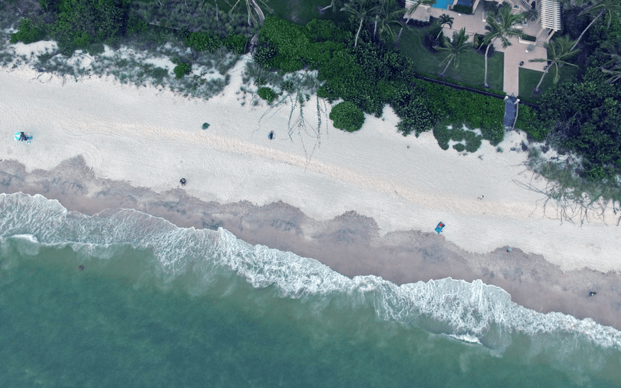
You can change a house, but you can’t change the water. If you’re eyeing Aqualane Shores, the right waterfront lot will make or break your boating and build plans. You want fast Gulf access, a dock that fits your boat, and a site that won’t surprise you with costly seawall or permit issues. This guide gives you a clear, boater-first checklist so you can compare lots with confidence and move quickly when the right one appears. Let’s dive in.
Water access and canal reality
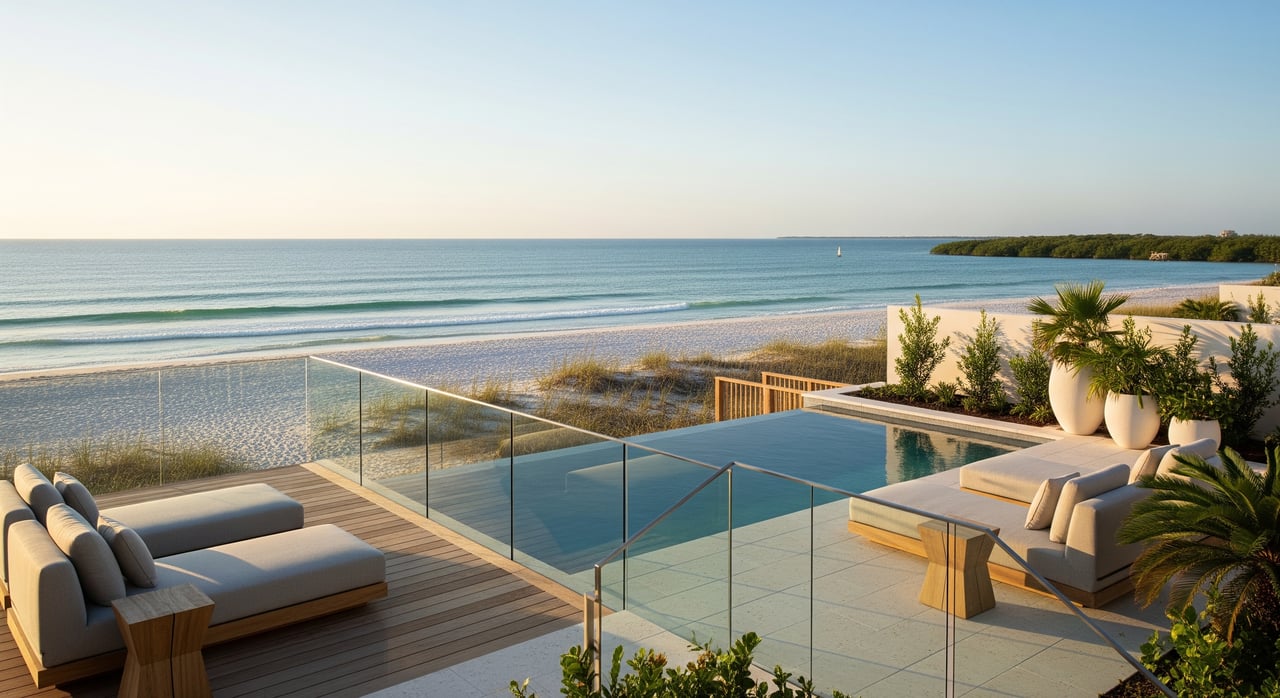
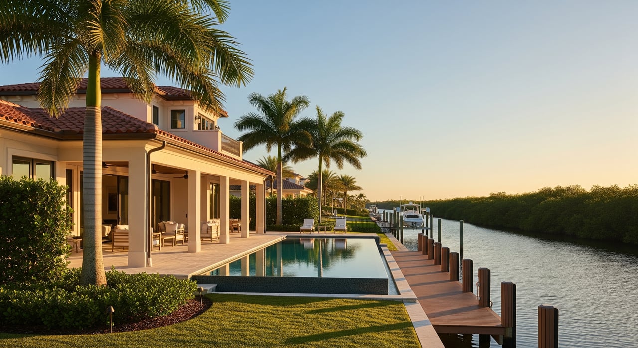
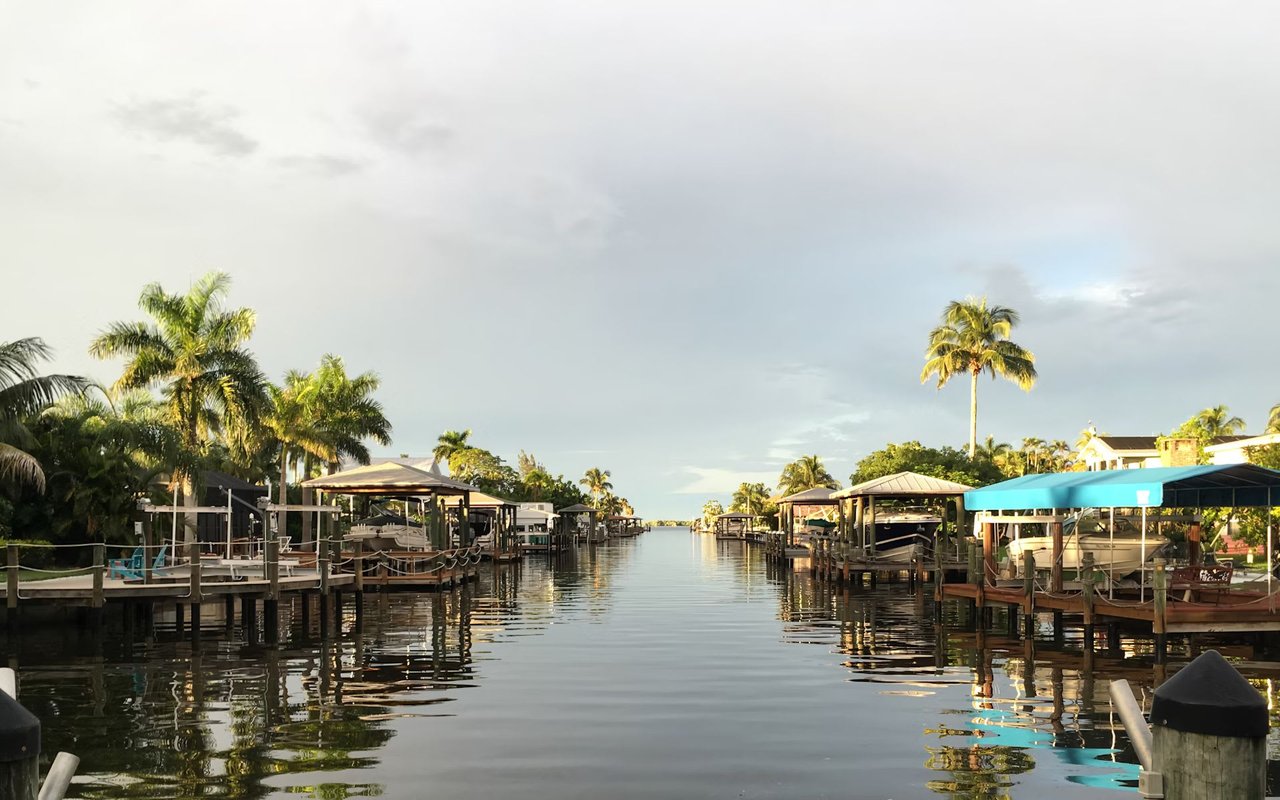
Aqualane Shores sits on dredged canals that connect to Naples Bay and then out through Gordon Pass. The appeal is obvious: short runs to open water with a true Naples lifestyle. Each canal has its own width, turning options, and shoaling history, so comparing lots by canal name and location helps you spot practical differences. For neighborhood context, start with the Aqualane Shores Association.
Map your route to Gordon Pass
Plot the full path from dock to the Gulf. Measure the nautical miles and note any narrow canal mouths or no-wake stretches that add time. Ask for recent underwater soundings along the route at mean low water so you know where the skinny spots are. If you run a deeper draft, this is often the difference between enjoyable and stressful boating.
Watch air draft and overhead lines
Fixed bridges are uncommon on direct routes here, but overhead utilities, tree canopies, and private structures can matter for flybridges, towers, and antenna masts. Confirm your air draft with a margin of safety. If it’s tight, consider whether a different canal or a bayfront lot fits you better.
Dock rules that shape design
City rules define how far, how wide, and where your dock can sit. Knowing these limits prevents surprises after you buy.
City limits you should know
The City of Naples code generally caps piers at 22 feet waterward from the toe of riprap. For lots fronting Naples Bay and Gordon Pass, there is an exception that can allow you to extend farther to reach 5 feet at mean low water, but it triggers added side setbacks and extra review. Shore-parallel docks also have length and width caps, plus a 25 percent waterway-width rule that limits how much of the canal you can occupy. Review the city’s zoning text for your parcel before you assume anything about dock size. See the reproduced ordinance language on Naples zoning and pier code.
Lot width and build envelope
Minimum lot widths and setbacks vary by zoning and affect both house placement and dock design. Narrower lots can limit shore-parallel dockage, pushing you toward a shore-normal pier even for larger boats. Confirm the lot’s zoning and ask the City how those rules shape your construction envelope.
Depth, turning, and boat fit
Boat fit is about three things: depth, turning room, and usable berth length. Check each one on a lot-by-lot basis.
Depth at MLLW
You want soundings taken at or adjusted to mean lower low water so you can plan with a safety margin. Compare your loaded draft to those numbers and aim for an extra 2 to 3 feet of clearance at low water for most powerboats. Naples station data and datums are available via NOAA Tides & Currents.
Turning room that feels comfortable
As a general rule, plan for 1.5 to 2 times your boat length for comfortable turns, more if wind and current run strong. Turning basins help larger yachts; narrower canals favor more maneuverable craft. Walk the site at different tides and watch how boats of your size operate nearby.
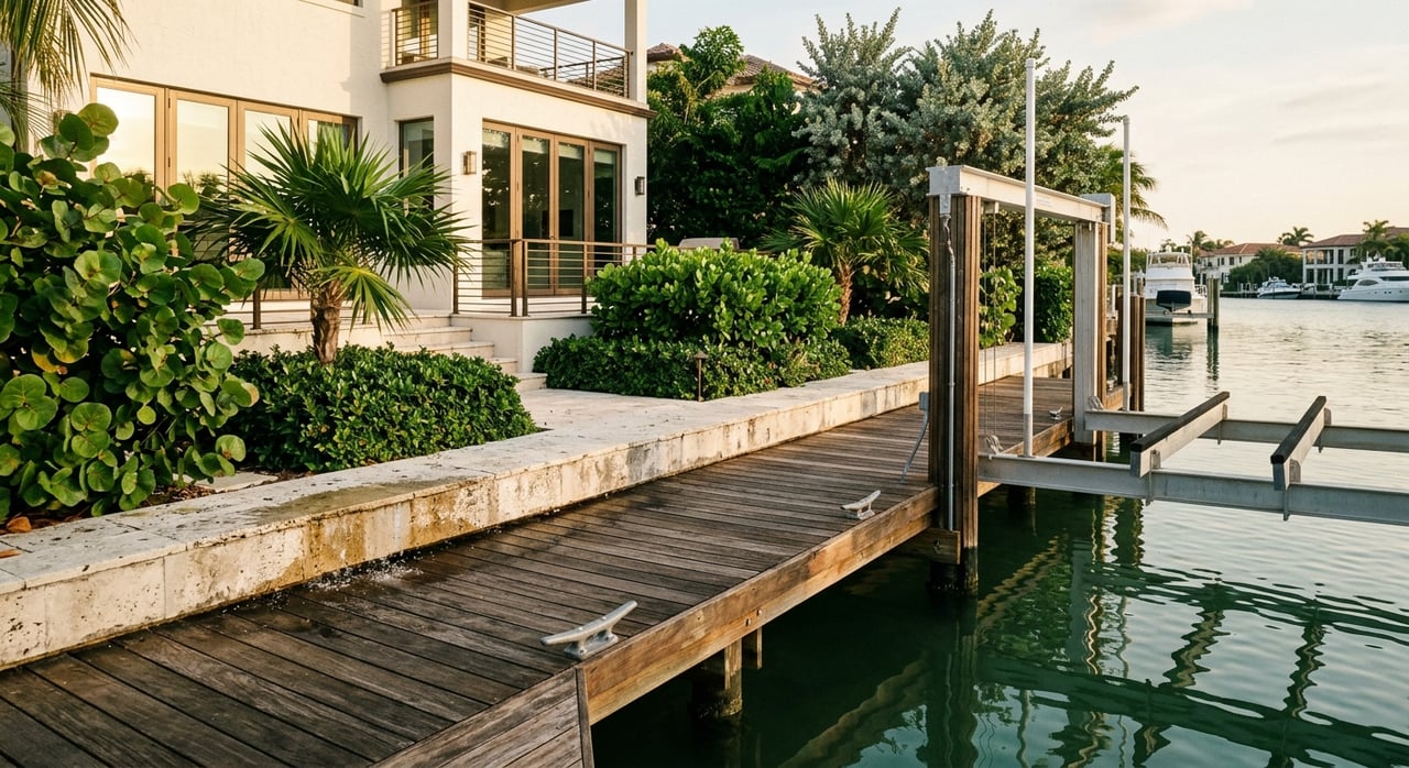
Usable berth length, not just dock length
The listed dock length can overstate what you can actually use. Measure clear space between pilings or fingers and deduct lift structure and required buffers. Ask for as-built plans and current photos to confirm real, usable length.
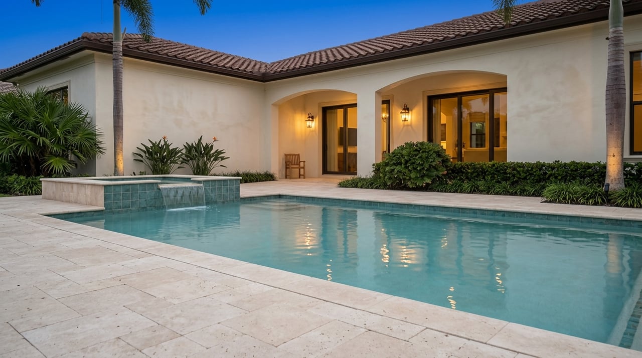
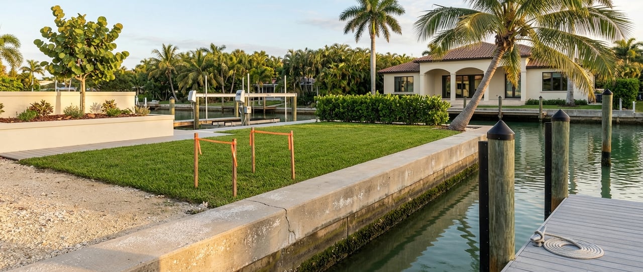
Seawall condition is critical
A tired seawall can sink your budget. Many walls here are decades old and nearing the end of their useful life.
- What to inspect: cap cracks, spalling, separation, lean or bulge, missing anchors, sinkholes or soft backfill, and toe scour. An underwater look at the toe and seabed profile is often essential.
- Lifespan and cost: concrete seawalls commonly last about 30 to 50 years depending on exposure and care. Replacement often runs hundreds of dollars per linear foot, but local bids vary with site conditions. For context on lifespan and inspection items, review this overview on Florida seawalls.
Flood, elevation, and insurance
Flood maps guide design, insurance, and resale expectations. Pull the current FEMA FIRM panel and an Elevation Certificate if available.
- Check the City’s mapping and 2024 updates on Naples flood zone maps.
- Get the official FIRM and base flood elevation at the FEMA Map Service Center.
- Ask your builder how freeboard and elevation requirements will affect foundation type, garage placement, and finish floor height.
Environmental and dredging constraints
Work in and around the water can require reviews beyond the City. Plan time and budget accordingly.
- State review: mangrove trimming or removal, work below mean high water, and seagrass impacts typically involve the Florida Department of Environmental Protection. Start with FDEP’s program index to confirm the South District contacts and rules.
- Federal review: dredging and work in navigable waters can trigger U.S. Army Corps of Engineers permitting. See the Corps’ overview of how to obtain a permit.
- Local responsibility: some canals are maintained by the City or by assessment districts, while others are private. Review recent City discussions on canal dredging and non-ad valorem assessments to understand current practices and possible costs.
Cost and timing reality
Budgeting and scheduling early will save you from tough choices later.
- Seawalls: planning figures from Florida contractors suggest a wide range, often a few hundred to roughly 1,000-plus dollars per linear foot depending on material, access, and engineering. Use this only as a starting point and get multiple local bids. For a planning overview, see a Florida contractor’s notes on seawall costs.
- Docks and lifts: length, pilings, lift capacity, and electrical scope drive price. If dredging is required to achieve berth depth, state and federal review and potential mitigation can dominate the budget and the timeline.
- Permitting timelines: simple in-footprint repairs can move in weeks to a few months. New dredging or seagrass impacts can extend timelines to many months, sometimes longer. Build that time into your purchase and construction plans.
Who to hire before you buy
Bring the right specialists in early and make their reviews part of your offer.
- Marine surveyor or hydrographic contractor to take soundings at low water and map shoals.
- Coastal engineer or qualified marine contractor to assess seawall condition and repair or replacement feasibility.
- A Naples-savvy custom home builder to size the build envelope and advise on likely dock and lift conditions.
- A Professional Mangrove Trimmer if mangroves are present and trimming is contemplated.
- A title or closing attorney to check riparian rights, recorded dock easements, and any canal assessments recorded in title.
Offer-ready document checklist
Before you write an offer, request these and make them contingencies where appropriate:
- Current ALTA or boundary survey with riparian lines, toe of riprap, and as-built dock and seawall.
- All dock, lift, and seawall permits and as-builts. Confirm if any features are nonconforming under current code. Reference the Naples zoning and pier code when reviewing.
- Seawall inspection report with photos and notes on cap, anchors, drainage, and toe condition. See the overview on Florida seawalls for what pros look for.
- Hydrographic soundings along the route to Naples Bay at low water, tied to NOAA datum. Naples station references are on NOAA Tides & Currents.
- City permit history and any open code items tied to the parcel.
- Title search for riparian rights, easements, covenants, and any dredging or canal maintenance charges. Review recent City materials on canal assessments.
- Elevation Certificate or the site data needed to produce one. Verify mapping at FEMA’s MSC and compare with Naples flood zone resources.
- Environmental pre-check if mangroves or seagrass are present, including a quick jurisdiction review via FDEP’s index.
- Insurance pre-qualification that reflects seawall and dock condition and any required repairs.
Red flags that merit a pause
- Structurally compromised seawall without a clear, budgeted repair plan.
- No documented riparian or dock rights.
- Repeated shoaling at the canal mouth with likely high dredge costs.
- Location in a flood zone that makes your target design impractical.
- Unresolved or uncertain canal assessments in title.
Ready to compare lots with confidence
The best Aqualane Shores lots deliver quick, comfortable access to Gordon Pass, a dock that matches your boat, and a buildable footprint that suits your home vision. With the right documents and experts in place, you can make a clean, confident offer when the right property appears. If you’d like a curated short list and a hands-on walkthrough of boat fit, seawalls, and permits, request a Private Consultation with the Rigsby Team.
FAQs
What makes Aqualane Shores appealing for boaters?
- Short runs to Naples Bay and Gordon Pass, a network of dredged canals, and a true waterfront lifestyle with varied lot and canal options.
How far can my dock extend in Naples?
- City code generally caps piers at 22 feet waterward of riprap, with exceptions on Naples Bay and Gordon Pass to reach 5 feet at mean low water, plus stricter setbacks and added review.
How do I verify water depth for a specific lot?
- Order recent soundings at mean lower low water across the dock area and canal route, and reference NOAA’s Naples station for datums and typical tides.
What should I look for in a seawall inspection?
- Cap cracks or spalling, separation or lean, missing anchors, sinkholes or soft backfill, blocked weep holes, and toe scour confirmed by an underwater check.
Do I need permits to dredge near my dock?
- Yes. Dredging typically involves state review by FDEP and often USACE coordination, with seagrass avoidance and mitigation conditions.
How long do dock or dredge permits take?
- Simple in-footprint repairs may clear in weeks to a few months; projects with dredging or seagrass impacts can take many months or longer depending on surveys and mitigation.